Page last updated 28th May, 2012
Please contact us if you have any comments about this page or if you have any problems with it.
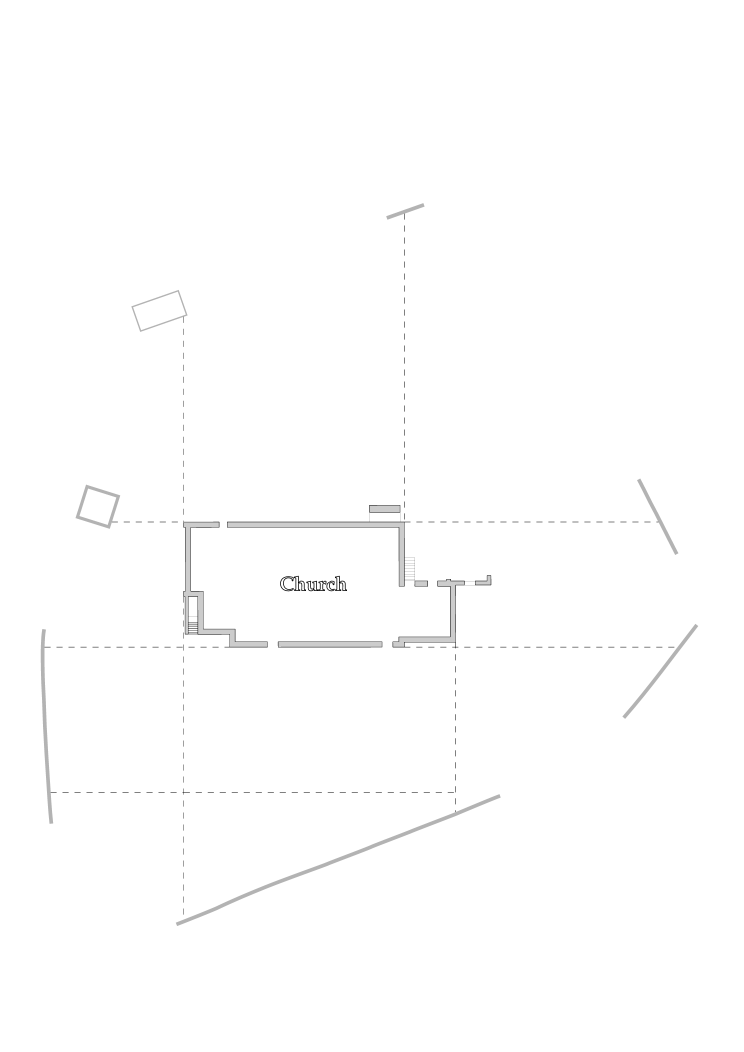
Drawing a Graveyard Plan |
|||
|
Stage 2
|
Stage 2 Use the twine to 'extend' the line of the church walls to the boundaries of the graveyard. Walk backwards towards the boundary while sighting along the line and the church wall. Insert a steel peg and washer fully into the ground at the point where the line meets the boundary. Measure the distance from the corner of the church to the boundary, inserting another peg at 30 metres (or less) if the distance to the boundary is greater than that. In this way you can start to form a grid of points, which can be adapted to suit the particular layout, and extended to cover the whole graveyard. The steel pegs and washers used as markers can remain in place until the survey has been completed. Using the washers makes these grid markers easier to find, especially in grass. It is important to drive them fully into the ground, so that they will not interfere with grass cutting, and they are less likely to be disturbed by other people. If the outline of the church has too many irregularities, such as buttresses, porches, etc., mark a line parallel to each wall of the church at a suitable distance from it, say 2 metres, for example. The resulting rectangle can be used as a central reference from which to measure outwards throughout the graveyard, and inwards to record the irregular outline of the church. Extra care will be required to make sure the sides of the rectangle are extended out to the boundaries in straight lines.
|
||